

80 million people use wheelchairs. It’s not always easy going. Is the pavement smooth enough? Is there a curb drop? Does a seemingly accessible route suddenly become impossible to navigate? Mainstream maps don’t tell you these things, they miss over 85% of surface quality data – and not knowing can cause more than inconvenience. Rough ground causes chronic pain from vibrations and 83% of disabled users report trip-planning anxiety.
Serviceplan Germany and European shared mobility app, Bolt, wondered what if scooters could do more than just get people from A to B? What if they could help make cities more accessible? The result is a project Wheels4Wheels, that gives wheelchair users street-level information on the most crucial factor for wheelchair navigation – surface quality. It repurposes sensors already fitted to Bolt scooters to collect accessibility data that mainstream maps have long been missing, and make it publicly accessible so that any navigation service, city authority, or developer can use it immediately and for free.
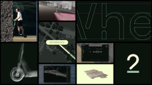
Wheels4Wheels uses accelerometers, gyroscopes, GPS receivers, and cameras already installed in scooters to support vehicle safety and maintenance to analyse the data recorded on daily trips and translates it to surface quality on a five-point scale.
The idea was tested in Tallinn, the capitol of Estonia. Bolt scooters covered 550 km across all eight city districts, capturing 40.5 million accelerometer readings and producing 66,088 individual surface ratings, with manual mapping conducted in parallel to validate the method. As a result, available surface-quality information across Tallinn increased by 26%.
“Every year, our scooters cover millions of kilometres across hundreds of cities, registering every bump, slope, and uneven surface along the way”, stated Ardo Reinsalu, director of vehicles at Bolt. “We have long shared that data with city partners to help improve roads and pavements for everyone. Wheels4Wheels takes that a step further by making the same information available directly to the people who need it most – without building a new app, but improving the maps they already use. This initiative changes how we think about scooters themselves, as something that goes beyond getting people around and actively helps make cities more accessible for everyone.”
Alex Schill, global chief creative officer at Serviceplan, added, “Wheels4Wheels shows how an existing platform can be reimagined as civic infrastructure. What began as mobility data for fleet operations becomes a practical tool for inclusion, turning a familiar urban service into an open resource for more accessible cities. We’re very proud to support a matter that hopefully improves the daily lives of thousands of people.”
Serviceplan Group Germany led the project and creative with 1ar labs for data & engineering. Production was by We Make Them Wonder, B.East (service production), and Nafta Films. Serviceplan Make led post production.